Exploring the Far Reaches of Organ Mountains Desert Peaks National Monument
December 20-25, 2024
What I appreciate most about the holidays is the quiet. While the rest of the world is busy with decorating, shopping and entertaining, we prefer to use this time for quiet contemplation in the wilderness. It has always been a challenge to find a place with good weather in late December. In years past, we've tried to stay below 3000 feet in Organ Pipe National Monument, the Dragoons and Anza Borego, among others. But this year? Anything below 7000 feet is fair game. Here at the end of December temperatures in Silver City are steady at 60-70 during the day and around freezing at night. There's been no winter at all so far. And while we're enjoying the "nice" weather, I wonder what price we'll pay a few months from now if these unusually high temperatures persist.
So this year when our original holiday travel plans collapsed, we decided to use the time to explore the far corners of the relatively new Organ Mountains Desert Peaks National Monument. We planned a six-day trek that would take us around the west side of the monument, through the Broad Canyon Wilderness Area and back via the Robledo Mountains Wilderness.
Apache Flats
Our first destination was a series of petroglyph sites in Apache Flats, and our first lesson was that you can't believe any maps of this area. There are 4-5 known sites in this area, but we quickly learned that many of the roads shown on the map don't exist on the ground. Indeed, there was no sign that they EVER existed. With a somewhat late start, we were only able to reach one of the sites, in a jumble of boulders by an old stock tank. The styles are a mixture of Jornada Mogollon, Apache and Mimbres, and date from 600 to 1000 AD.
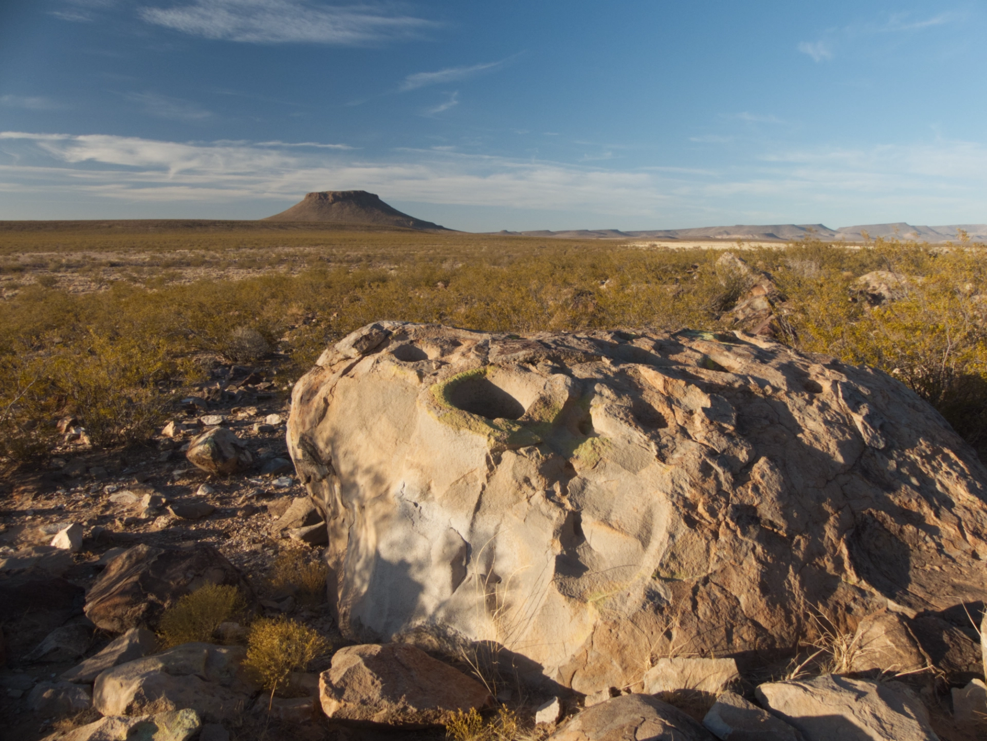
Bedrock mortars with a view of Massacre Peak at sunset.
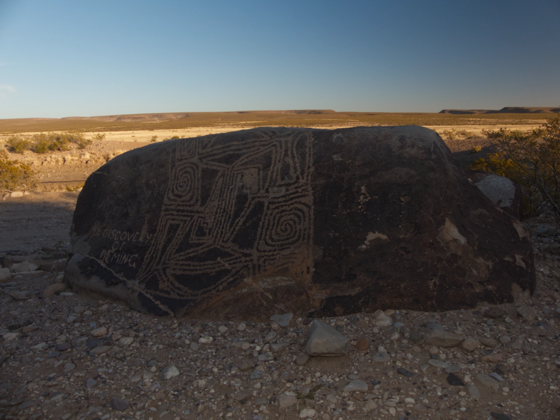
Vandalized glyph with a geometric pattern that resembles Mimbres pottery.
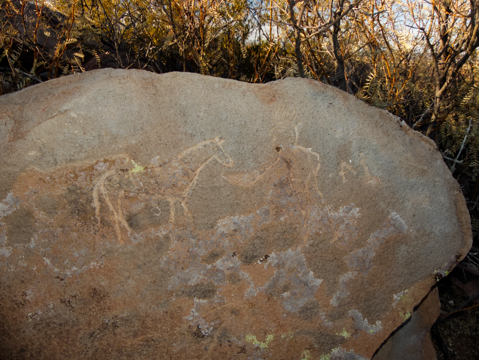
This certainly looks like a human figure with a horse, so it may be Apache in origin. In the early 1600s, Spanish settlers introduced the horse to the Pueblo Indians, who in turn traded it with the Apache.
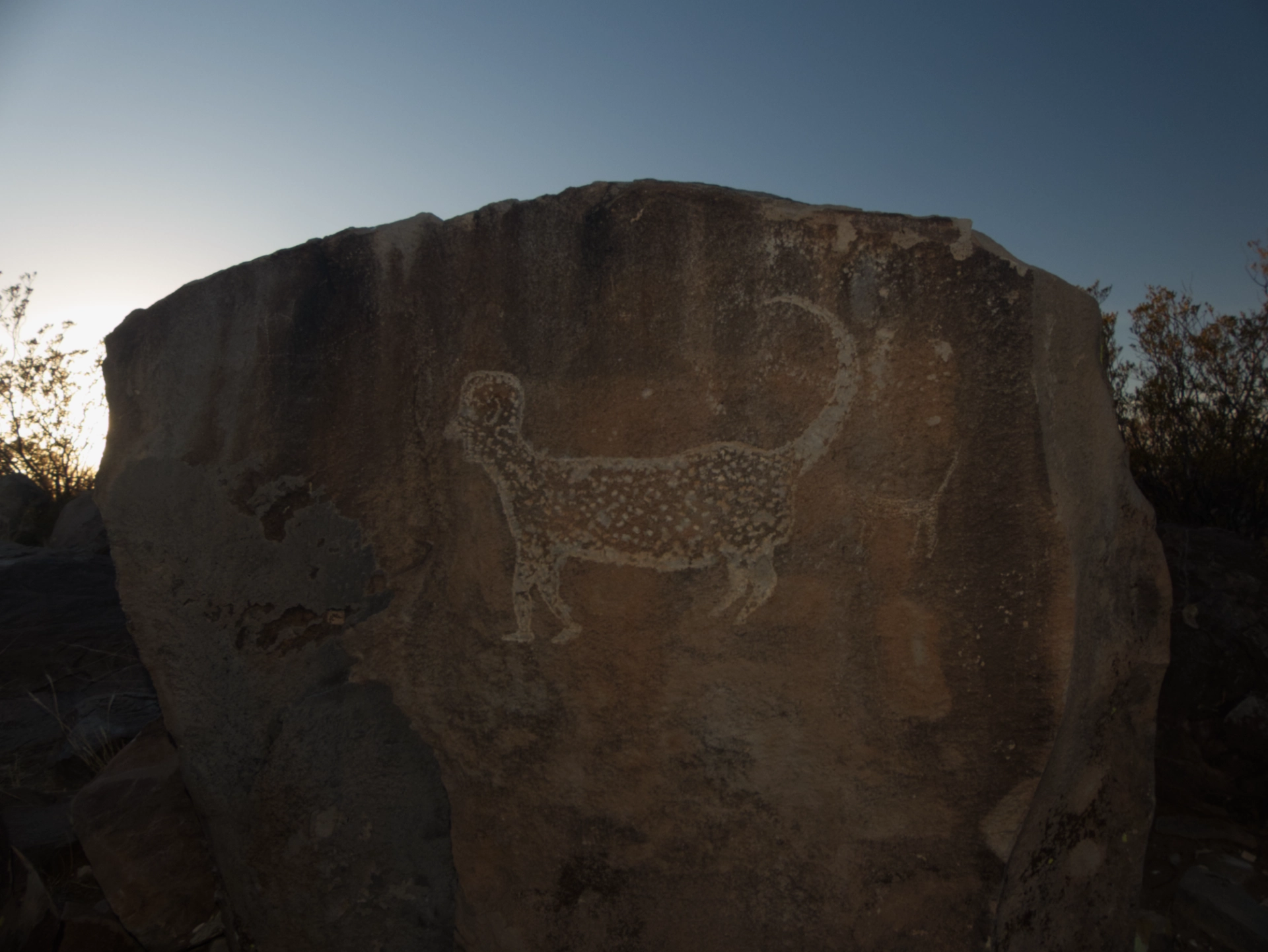
Interesting figure that looks for all the world like a jaguar with a human face.
Valles Canyon
Newly wary of the dotted lines on Open Street Map, the next morning we backtracked and headed toward Valles Canyon in the Broad Canyon Wilderness Area. True to form, a well-maintained gravel road that was actually paved for much of its length ran out at the gate to the Magdalena Peak Observatory. This left us with no alternative but a three-mile-long slog across a bleak desert.
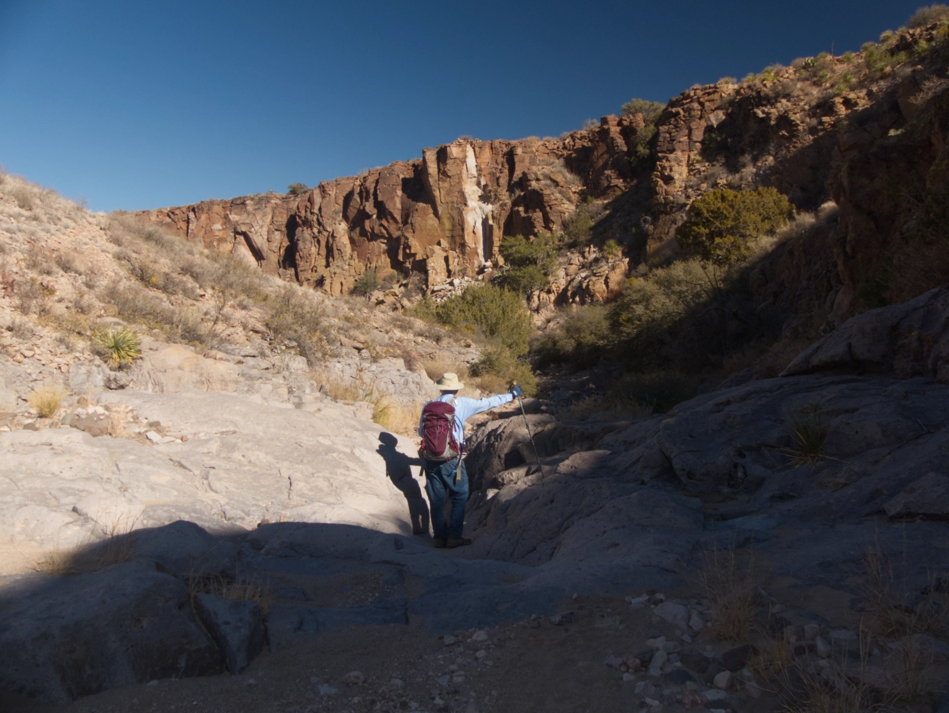
But then the canyon evolved into a nice slot with a magnificent panel of petroglyphs.
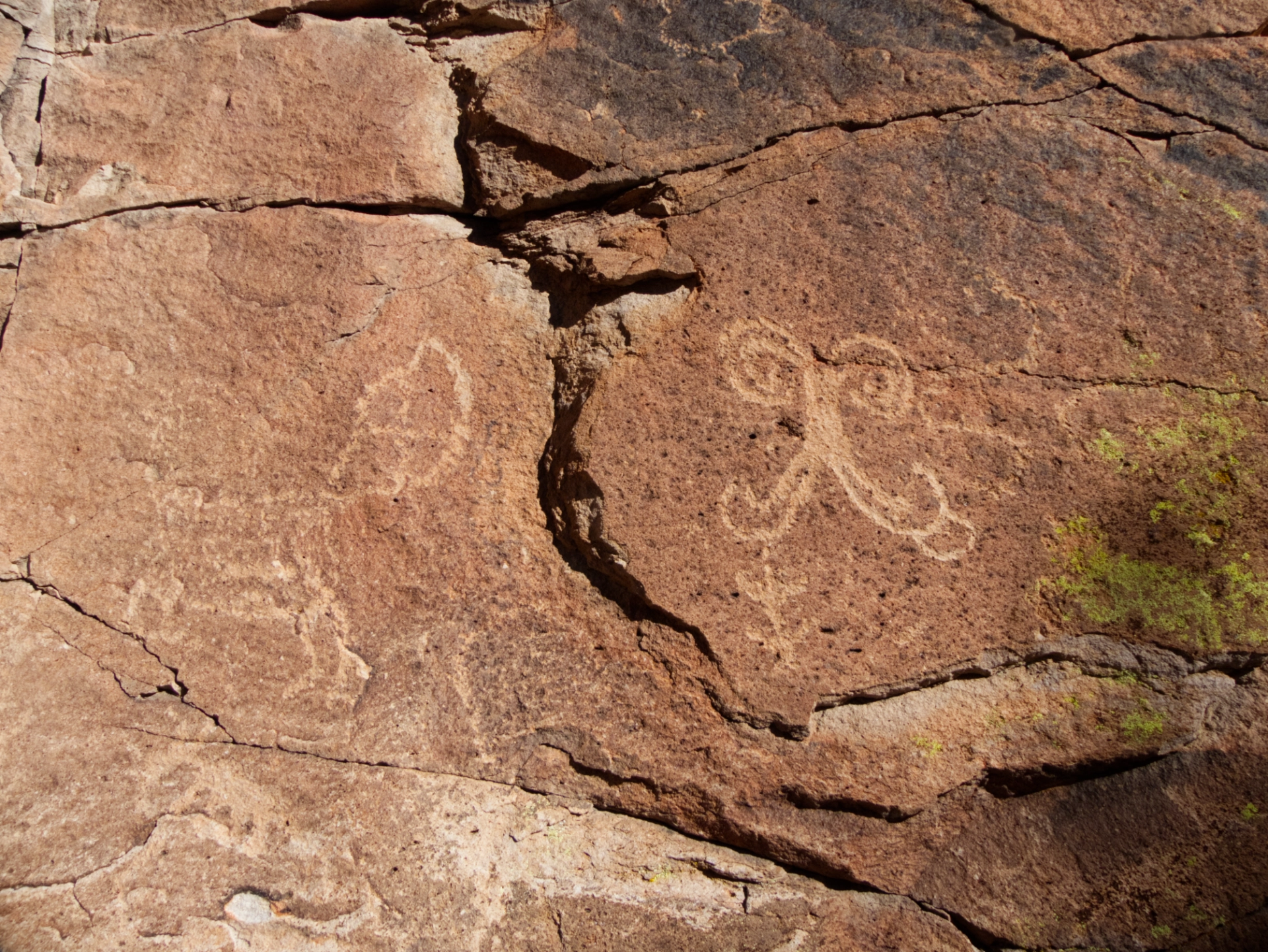
Is that a butterfly on the right?
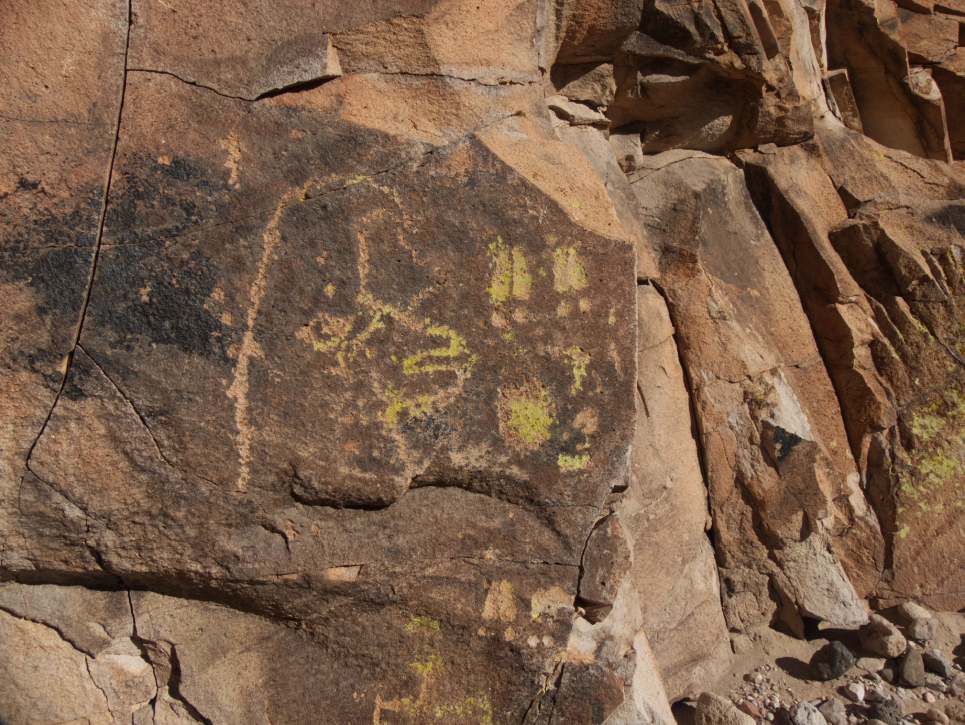
The more I look at this one, the more I see a bird with a fancy crest.
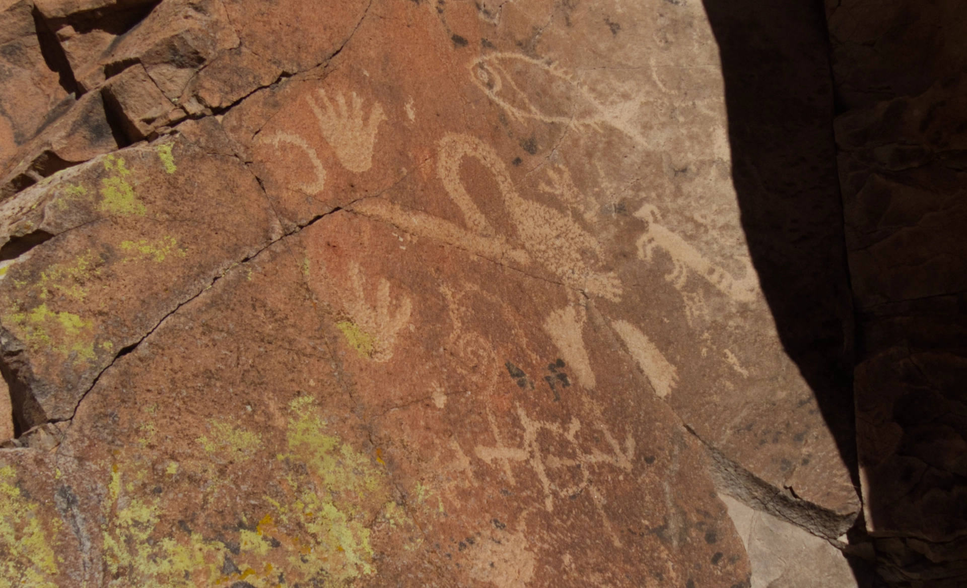
There's so much going on here. A fish, hand prints, and various creatures including one with a long tail and very large feet.
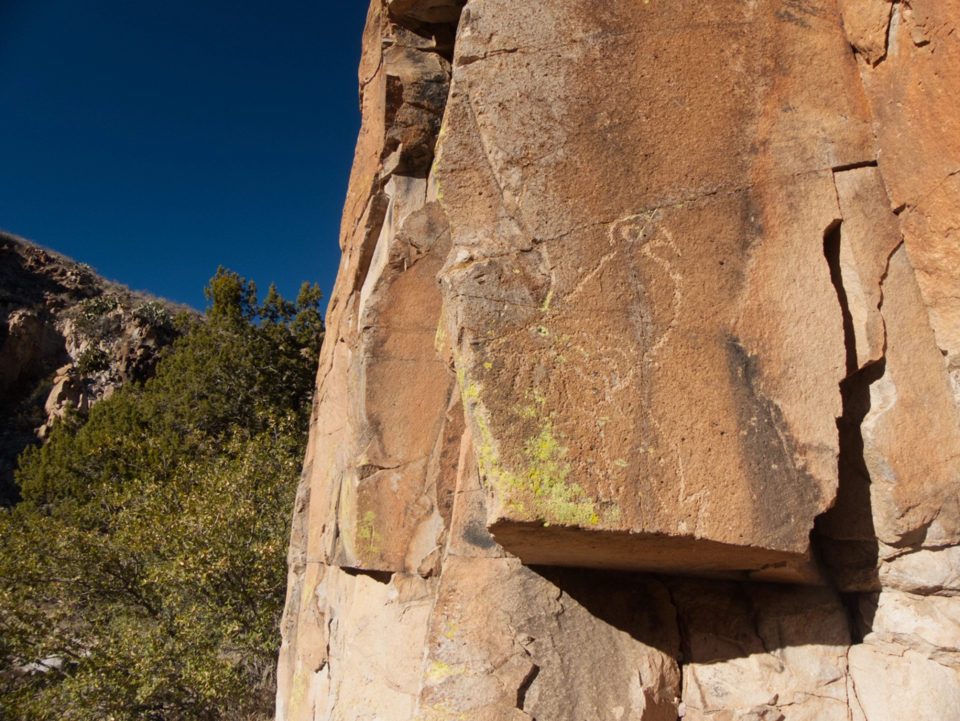
This resembles other petroglyphs I have seen that experts have identified as as macaws. Scholars seem to agree that macaw petroglyphs are evidence of an extensive trade network that existed among North American, Central American and South American native people.
After a hot and dry hike across the desert, it was magical to sit for a while in this deeply shaded canyon, imagining what a lovely oasis this must be when the water is flowing.

Our campsite that night was the best of the trip, atop a knoll in the shadow of Mesa Azur. Amazing views and absolute quiet.
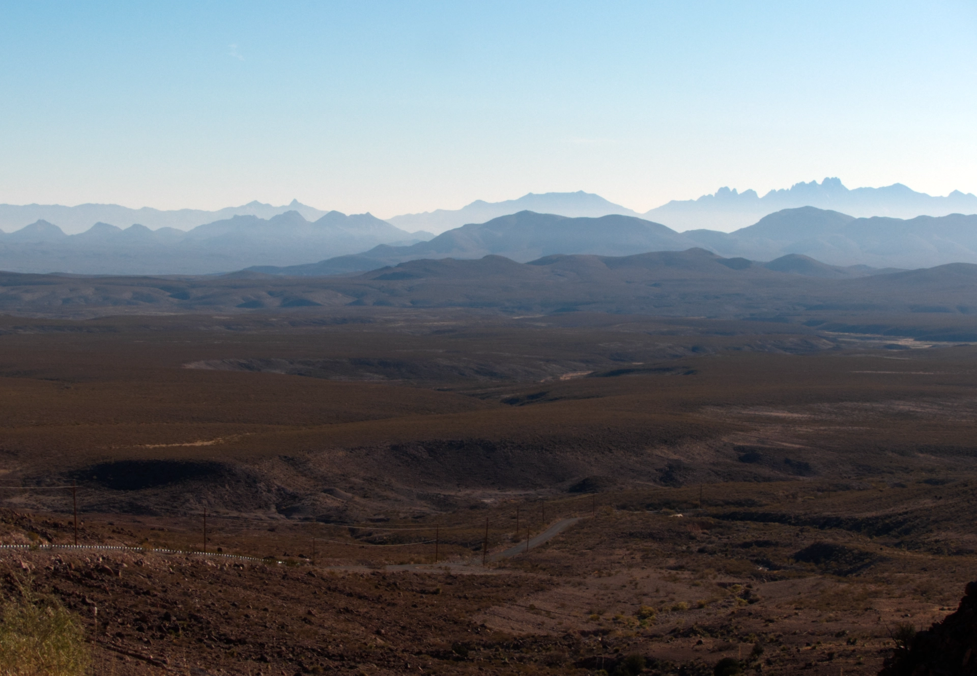
Blue ridges of the Organ Mountains in the distance.
Slot Canyon
Backtracking once again, we made our way around to the east side of the monument for the first of several hikes in the Robledo Mountains. This was the only hike where we encountered a "crowd" — a couple of dozen people, none of whom hesitated to clamber up and over the locked gate at the entrance. After a short hike along the salt-encrusted shore of the Rio Grande, the trail turns inland and enters a slot that is remarkable for both its depth and length. It was easily half a mile long, with crunchy granola mud stone walls soaring at least 60 feet.
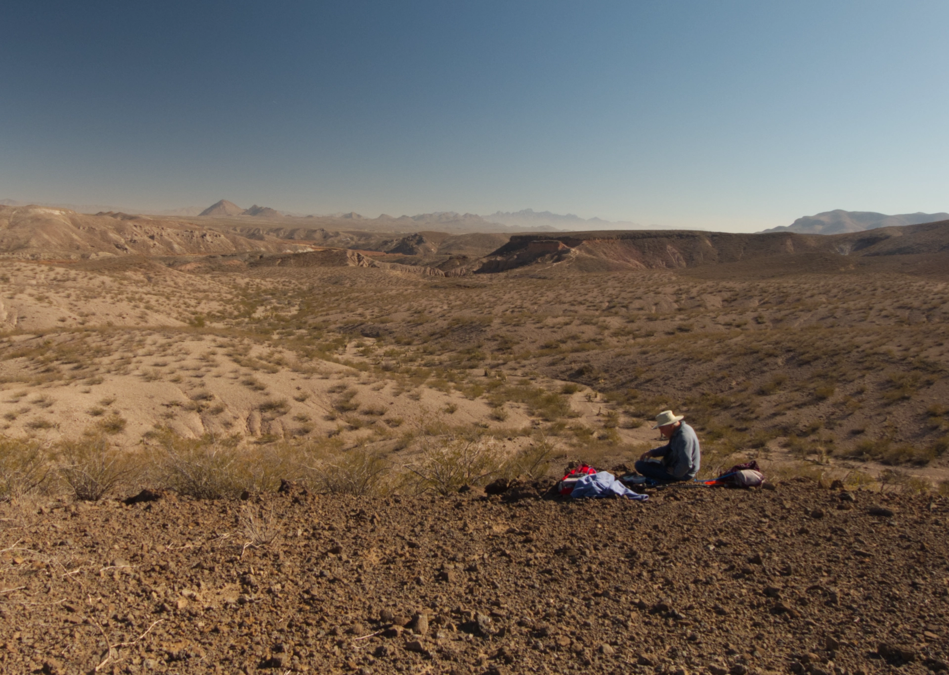
We continued out of the slot, following a figure-eight loop that lead us to a flat-topped basalt mesa with inspiring views in all directions.
Radium Springs
Since there's no camping within the monument, we booked two nights at Leasburg Dam State Park. The campground itself was lovely. Our site was nicely situated on a bluff overlooking the river.
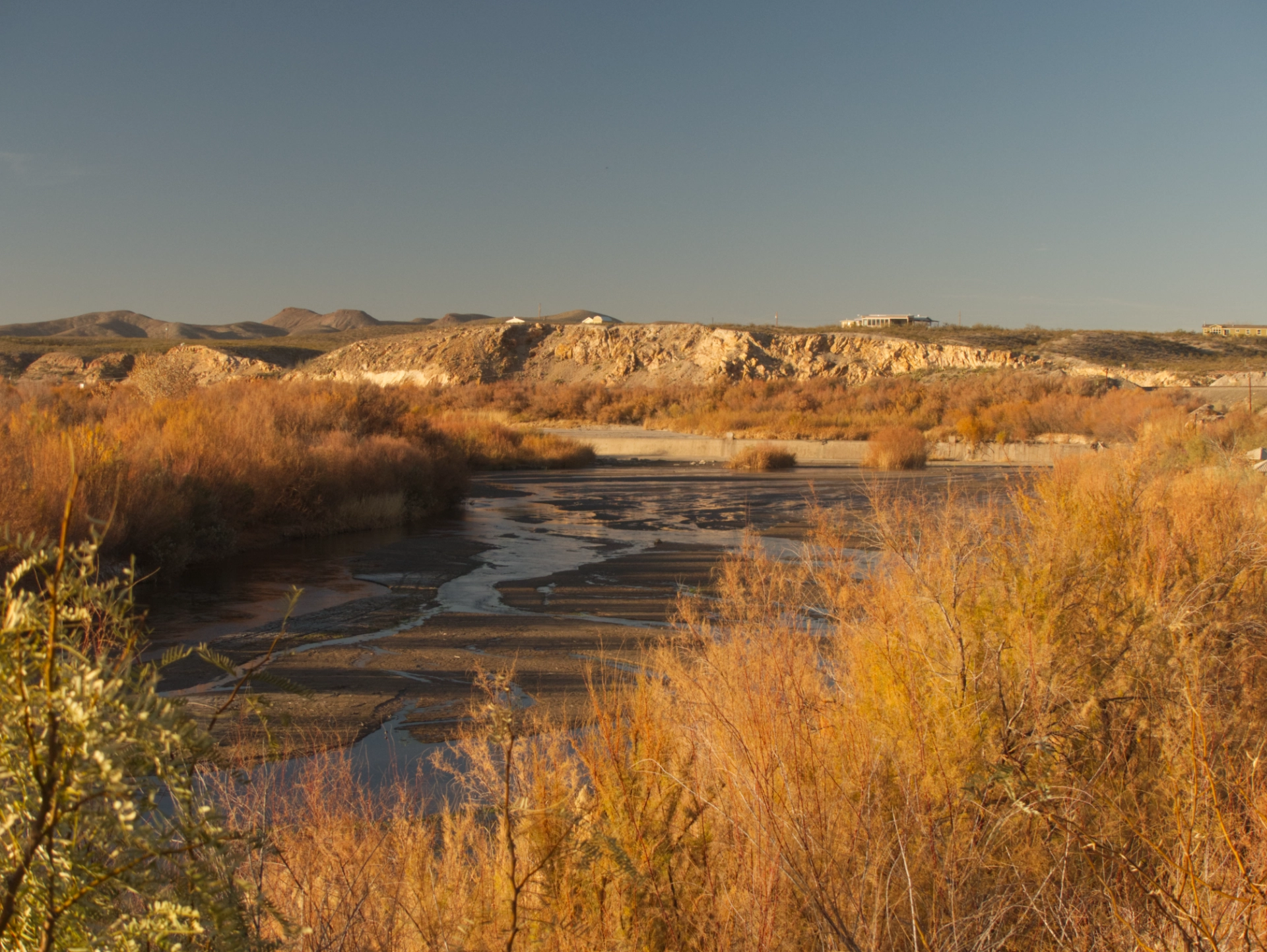
We took a sunset stroll along the river, marveling at the "swimming area" complete with bath houses and picnic shelters where the Rio Grande is reduced to a puddle.
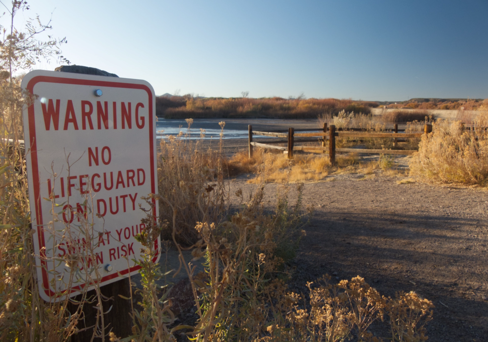
From Las Cruces north, the Rio Grande is given over entirely to massive pecan orchards. Just a thought, but if raising pecans sucks up all of the water in the river, maybe it's not the right place to be raising pecans?
Geronimo's Cave
Unfortunately Leasburg Dam State Park is surrounded by a wildcat development. Noisy ATVs and dirt bikes terrorize the 'hood at night, and a pack of dogs barked all night long, joined eventually by howling coyotes, only to be supplemented by crowing roosters at dawn.
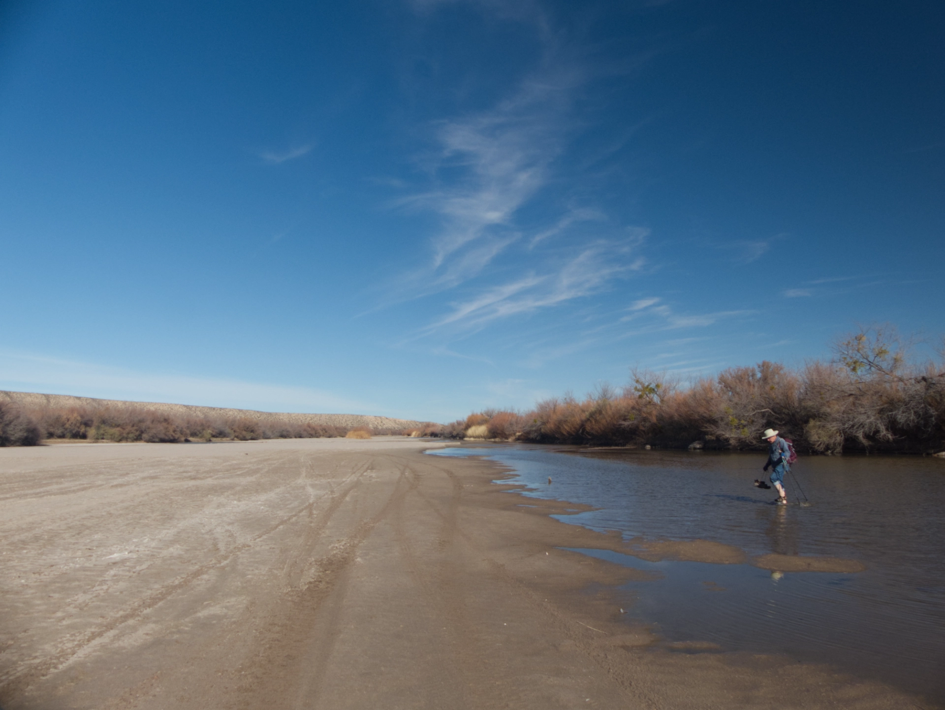
Our next destination was a cave on the far side of the Rio Grande. We approached cautiously, but found that the water, although very cold, was only a few inches deep.
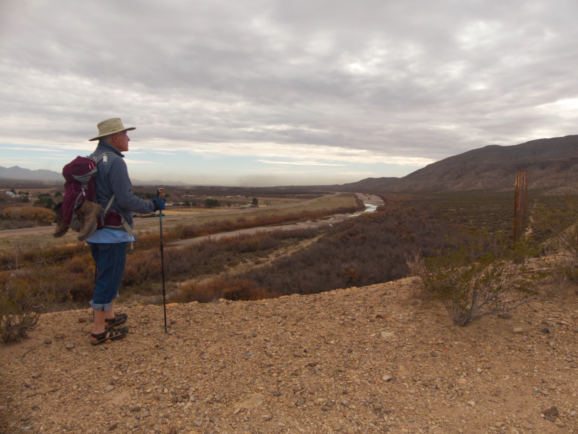
Looking down the Rio Not-So-Grande. A pall of dust seasoned with smog hung over Las Cruces.
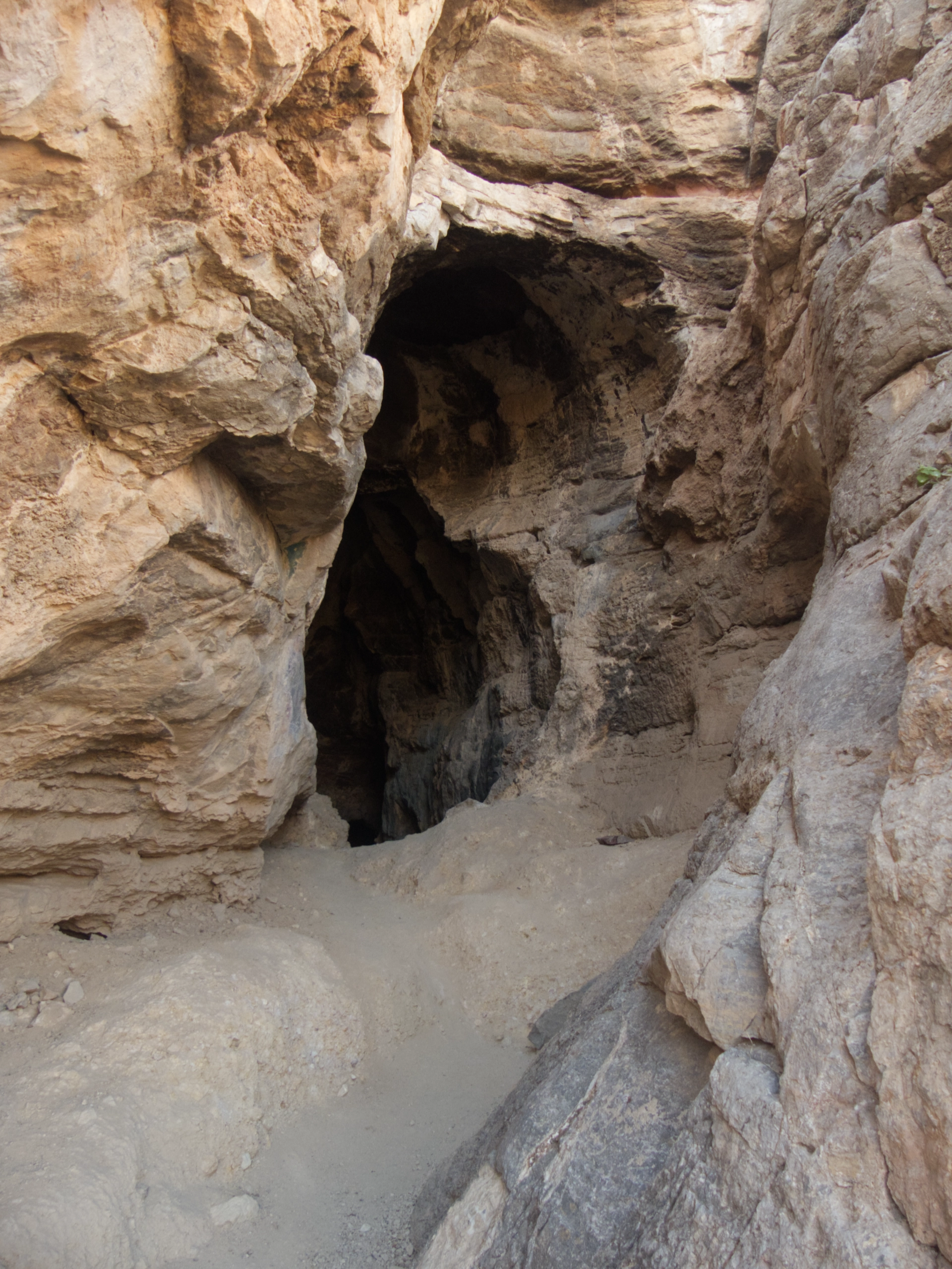
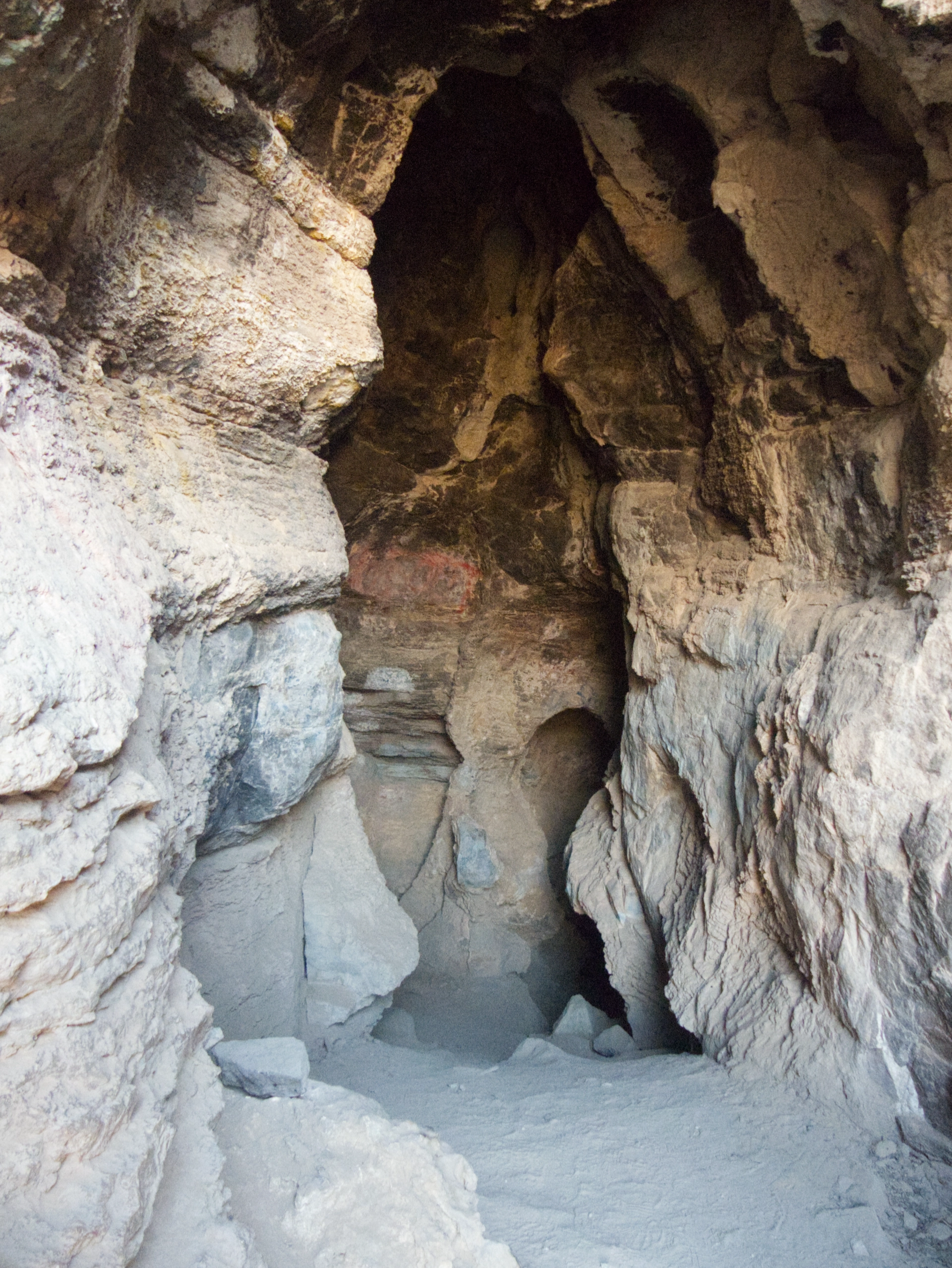
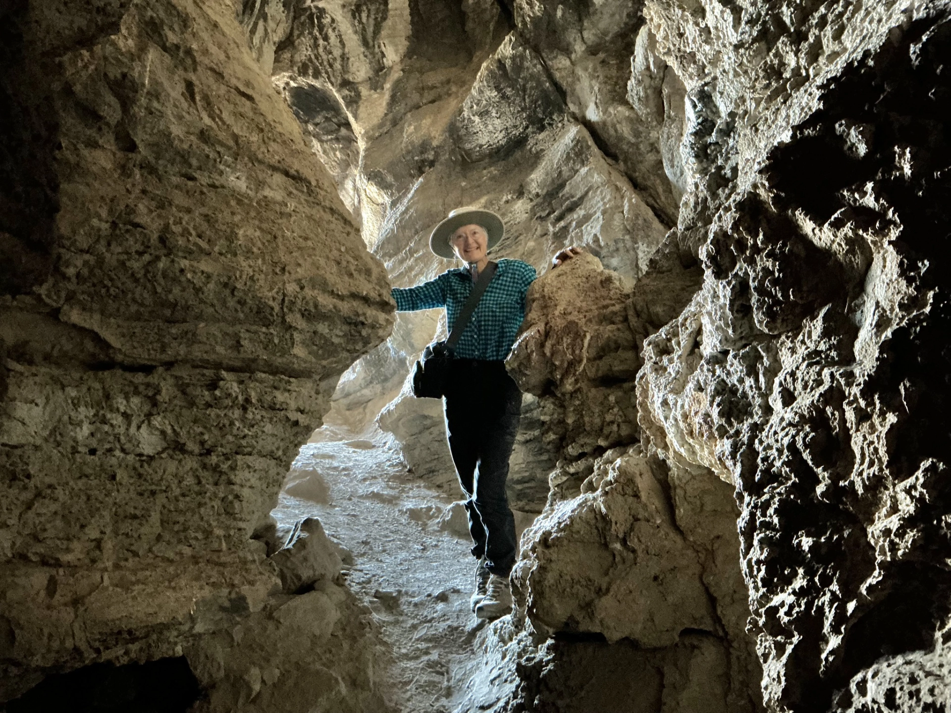
We only ventured about 50 feet into the cave, but it was a nice hike, with a trail that inched along the edge of a dramatic canyon.
Leasburg Slot Canyon
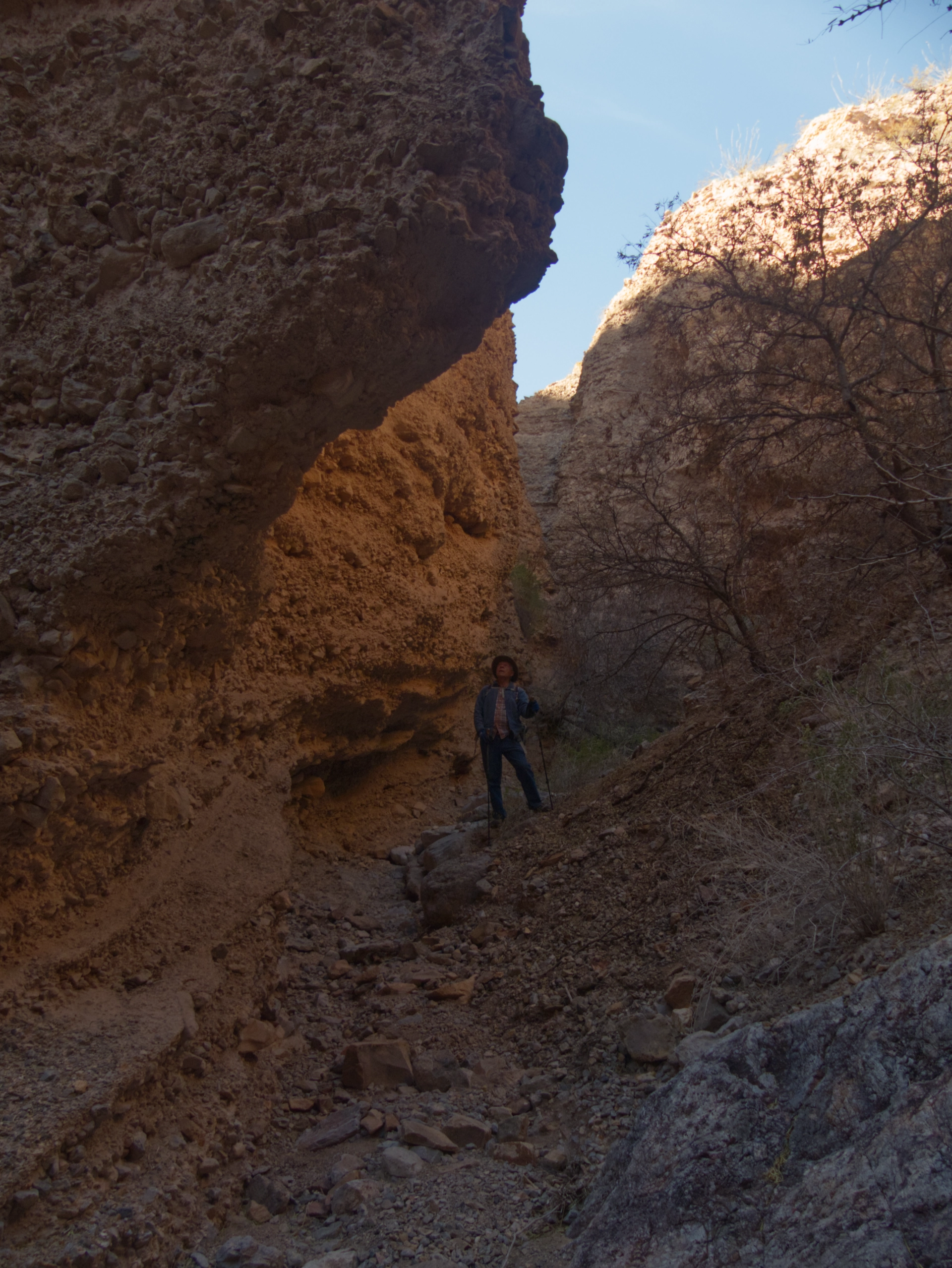
Our last official hike of the trip was Leasburg Slot Canyon. One reviewer on AllTrails described it as "not your grandma's slot canyon". Well I guess I'm grandma, 'cuz this one was not my cup of tea. Way too much brush and rockfall for me. We packed it in and headed for a nice lunch at La Posta in Old Mesilla.
Christmas Eve in Old Mesilla
One of my missions for this trip was to find a new perfume. I have worn Balenciaga for decades, but it was last produced in 2015. It was time to choose a new scent, but since I am very fussy about perfumes, I need to sample a few dozen before making a choice, and that means a trip to a store with a perfume counter.
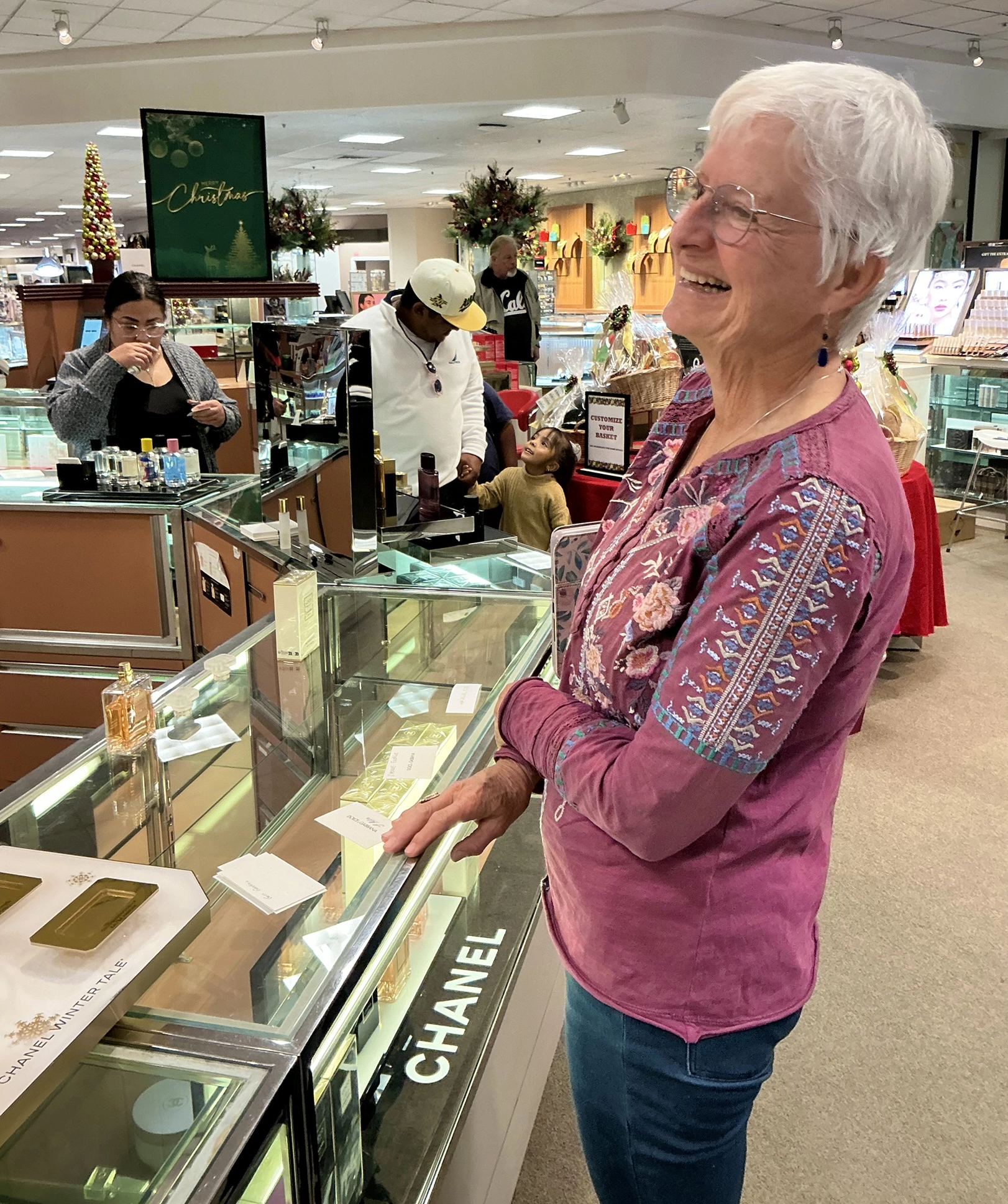
So here we are at Dillard's in Las Cruces, after five days of camping. It was the first time we'd been in a shopping mall in four years. We felt like the Clampetts rolling into Beverly Hills!
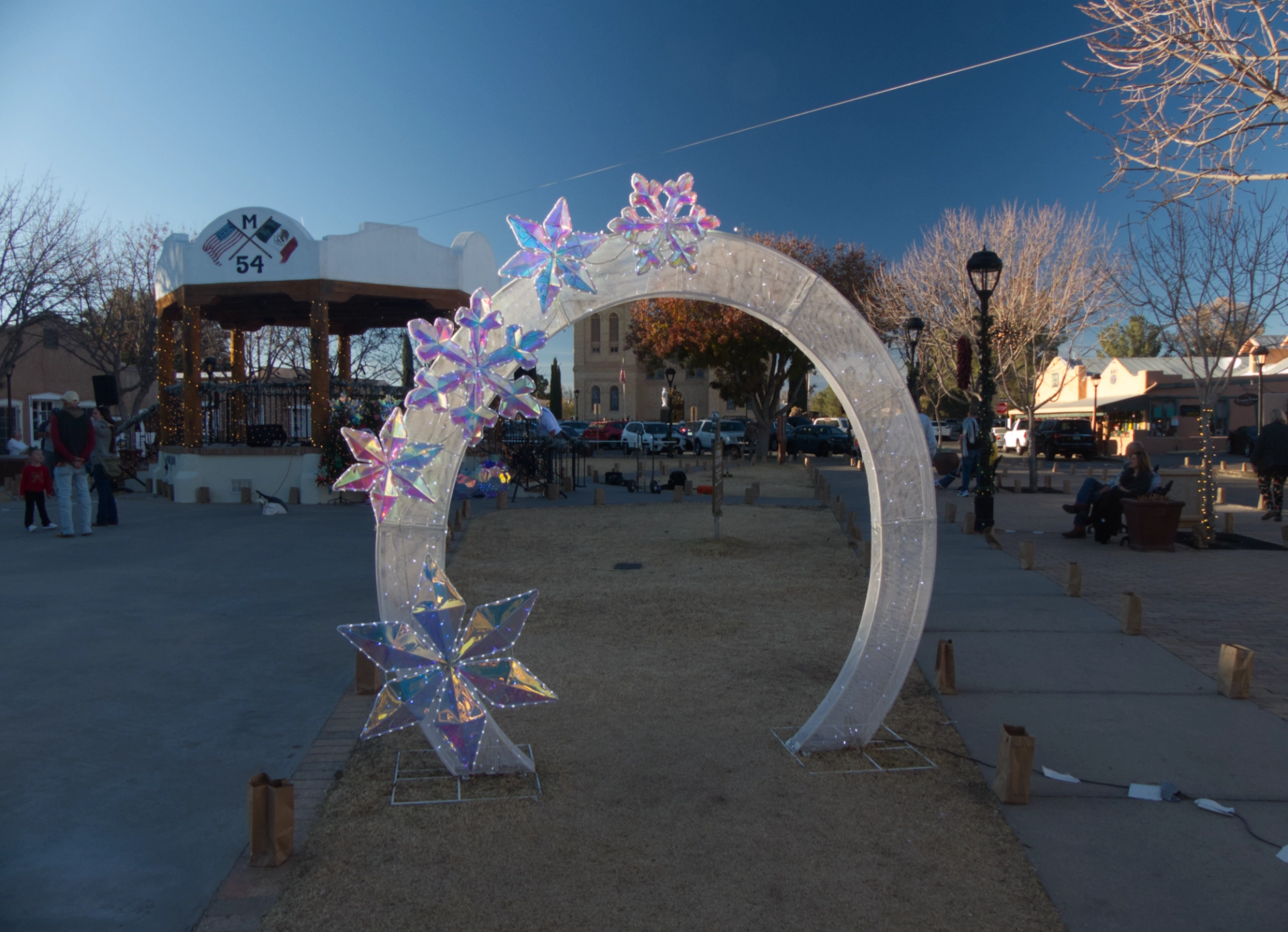
Christmas Eve in Old Mesilla. They do it up proper here, with caroling and luminarias outlining every rooftop, street and sidewalk.
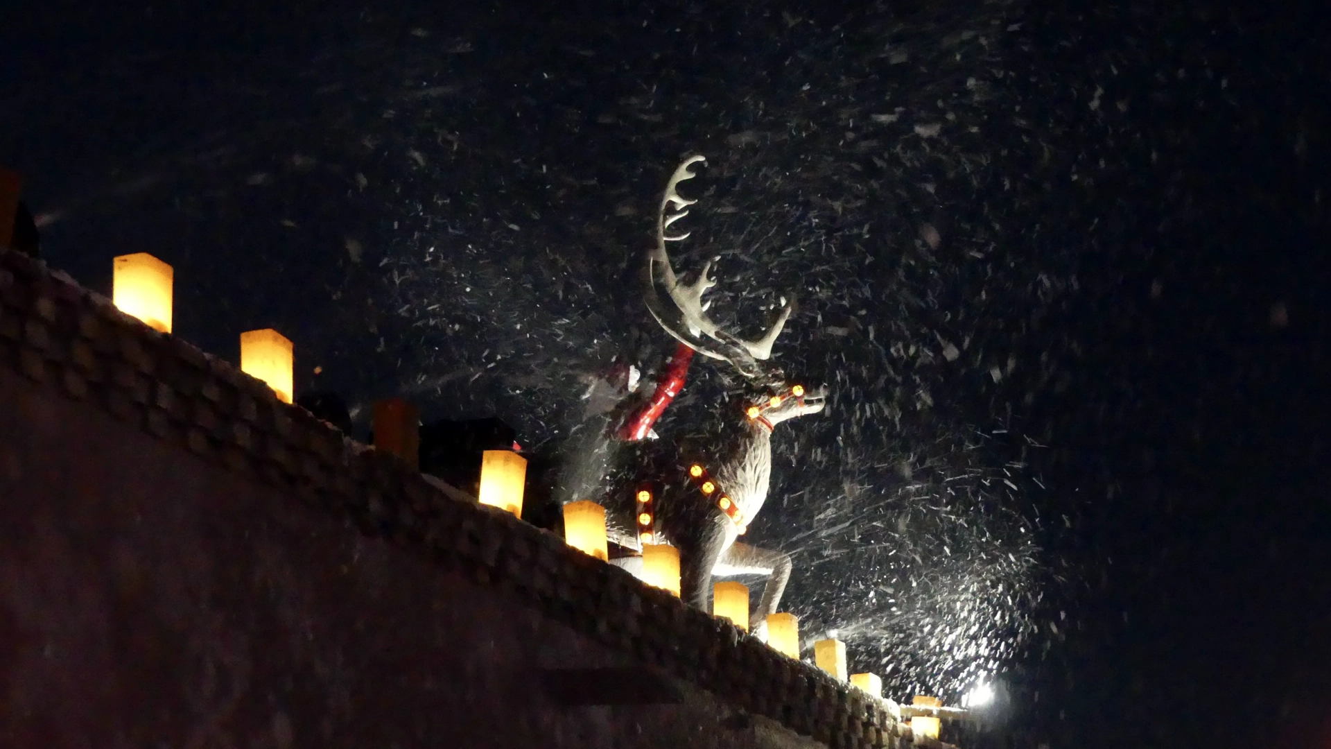
A snoapstorm atop Billy the Kid Gift Shop.
Seriously creepy toy soldier.
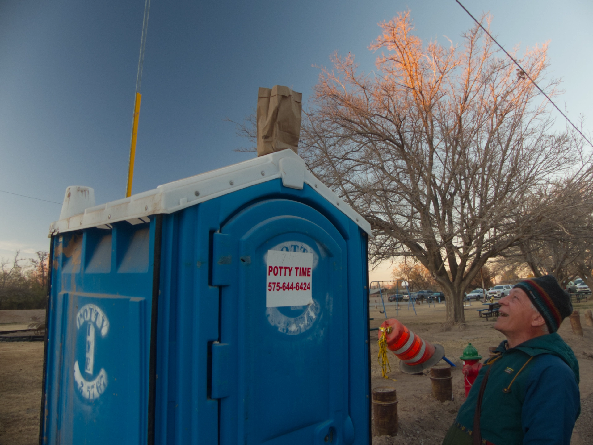
Even the sole porta potty was decorated with a luminaria.
Aden Crater
The final adventure of our trip was entirely unplanned. Leaving Old Mesilla well after dark, we were plowing through the red dirt south of I-10 in search of a campsite. Dodging locked gates, state trust property and no trespassing signs, we ended up on a two-rut track that bumped up against a wall of fractured lava.
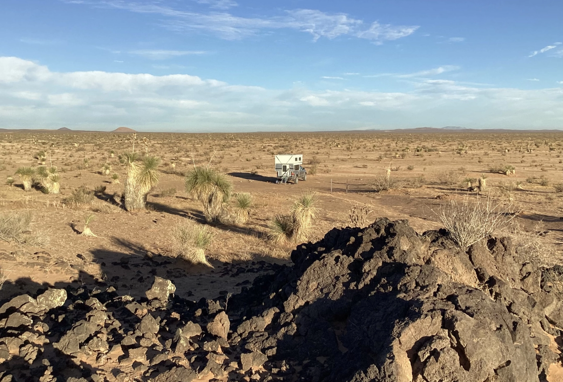
We awoke to find ourselves camped at the edge of Aden Crater,
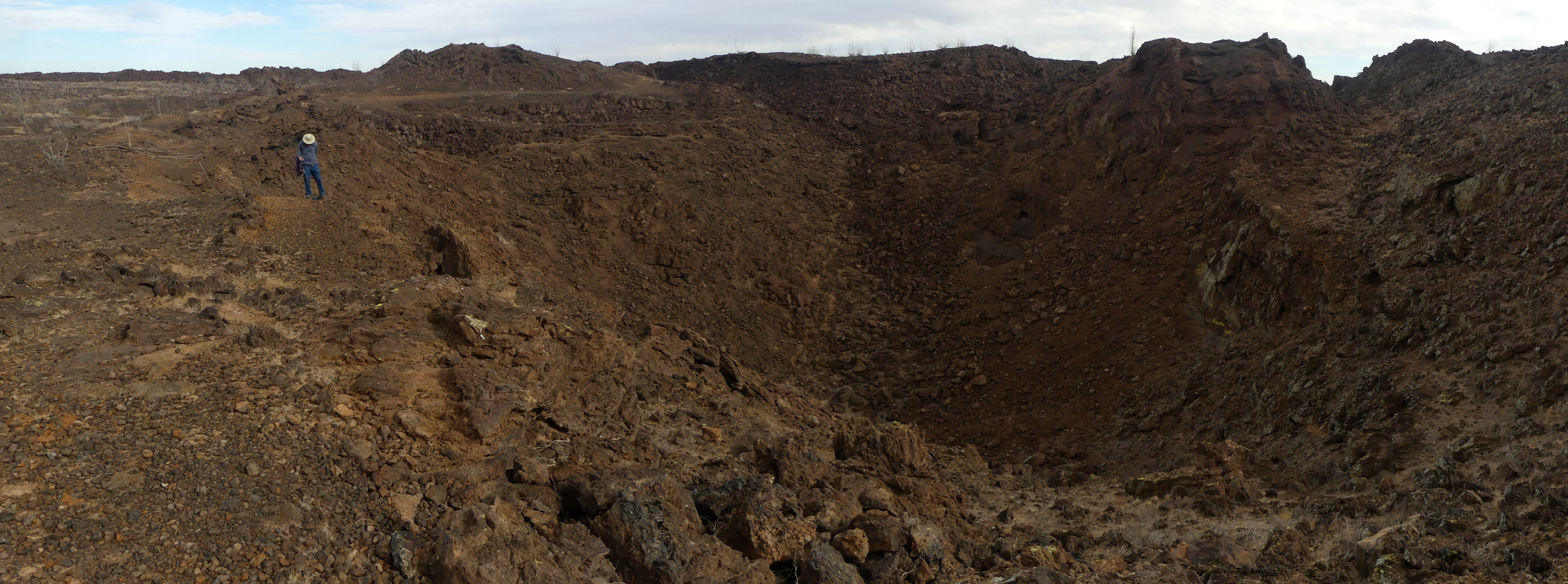
Wikipedia describes Aden Crater as a "shield volcano formed by repeated eruptions of very fluid olivine basalt." It occupies a low hill 3-4 miles in diameter topped by a crater about 1,400 feet in diameter that contains a former lava lake.
We dropped into the crater and then hiked all the way around it. Very fun unexpected adventures. The whole trip was amazing, and so close to home! In six days, we traveled less than 330 miles, and were never more than 100 raven-miles from home.
